Community Crime Map
The Kettering Police Department now provides an online tool that allows users to access crime data for the Kettering community. Provided in partnership with LexisNexis Risk Solutions, the Community Crime Map updates weekly with new data from the Kettering Police Department records system.
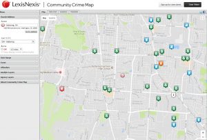
The Community Crime Map shows crimes in your area and allows you to sign up to receive crime alerts and neighborhood watch email reports of recent crimes in your neighborhood from the Kettering Police Department.
Getting information about crime data in your neighborhood is easy.
- Click "Visit our Community Crime Map" below
- Type "45429" of Kettering, OH in the search box
- Click "Filter" to show more options
- In the top right corner, you can change the date range
- Under "Events" you can select which types of crime you would like to see on the map
- On the map, click and icon to view more information about each crime
- Click on the icon shaped like a bell in the top right corner to sign up for crime alerts